Saba - The Unspoilt Queen

The ‘Caribbean quirks’ series will salute the delightful phenomena thrown up by the region which go against the overall stereotype. Starting off the series is an entire landmass: of all the islands in the Caribbean chain, from those off the coast of Venezuela in the south, to those stretching towards Florida in the north, Saba is unique.
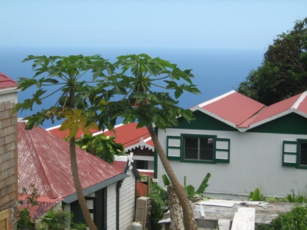
Saba is a tiny five-square-mile island that on a political level is a part of the Kingdom of the Netherlands. On a geographical level, too, this cone-shaped, steep-hilled, neighbor of St. Maarten and Statia feels like it broke away from a mooring off continental Europe and drifted to the Caribbean Sea. All cottages are painted white with ‘Saba green’ trim and shutters, capped by a sloping red roof, giving communities a quaint but charming feel that would not be out of place in a summer Swiss landscape.
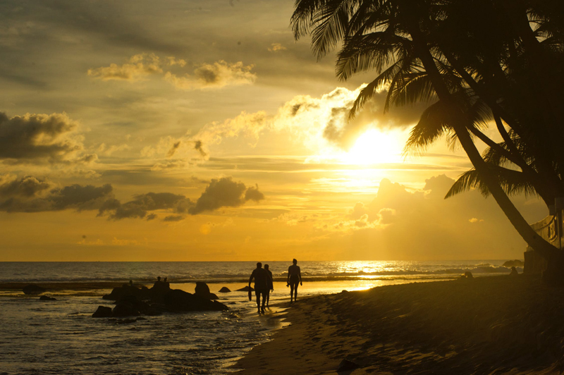
The quirkiness starts, though, at sea level. Saba is the Caribbean island with no beach; instead, the hillsides rise dramatically out the ocean and climb uninterrupted to the first settlement, the island’s capital The Bottom, at 650ft. There is a tiny strip of black sand at Well’s Bay, but for most of the year it is devoured by the waves.
The island topography rises past the small towns into rainforest, culminating at the 2,877ft. Mount Scenery, the highest point in the Kingdom of the Netherlands. Everywhere on the island seems to be perched on a slope or overlooking a ravine and there is barely enough flat land to swing a golf club, let alone set out a course.
Saba is a Dutch island, but English is spoken everywhere. Indeed, the majority of the island’s 1,500+ residents are descended from northern European settlers, belonging for the most part to either the Johnston or Hassell families, and are Caucasian in appearance rather than Afro-Caribbean.

Having subsisted throughout the island’s history through seamanship, Sabans are equally adept on land. The island’s one road, called ‘The Road’, began construction in 1938 and was laid out mostly by hand until all nine miles were completed in 1958. Previously, communities were linked by trails and hillside pathways, with goods carried up by ladder from ships and between villages by donkey or by hand. The first car did not arrive in Saba until 1947 and even today there is a single gas station only.
The only other way into the island apart from the ferry service to St. Maarten is by plane. Built in 1959, the Juancho E. Yrausquin Airport has the world’s shortest commercial runway – just 400 meters long. This hair-raising landing and take-off must be performed by a specially trained pilot.
Saba revels in its ‘unspoilt’ and perhaps unknown status, but its topography, culture and history make it also unparalleled.

Saba is a tiny five-square-mile island that on a political level is a part of the Kingdom of the Netherlands. On a geographical level, too, this cone-shaped, steep-hilled, neighbor of St. Maarten and Statia feels like it broke away from a mooring off continental Europe and drifted to the Caribbean Sea. All cottages are painted white with ‘Saba green’ trim and shutters, capped by a sloping red roof, giving communities a quaint but charming feel that would not be out of place in a summer Swiss landscape.
The quirkiness starts, though, at sea level. Saba is the Caribbean island with no beach; instead, the hillsides rise dramatically out the ocean and climb uninterrupted to the first settlement, the island’s capital The Bottom, at 650ft. There is a tiny strip of black sand at Well’s Bay, but for most of the year it is devoured by the waves.
The island topography rises past the small towns into rainforest, culminating at the 2,877ft. Mount Scenery, the highest point in the Kingdom of the Netherlands. Everywhere on the island seems to be perched on a slope or overlooking a ravine and there is barely enough flat land to swing a golf club, let alone set out a course.
Saba is a Dutch island, but English is spoken everywhere. Indeed, the majority of the island’s 1,500+ residents are descended from northern European settlers, belonging for the most part to either the Johnston or Hassell families, and are Caucasian in appearance rather than Afro-Caribbean.
Having subsisted throughout the island’s history through seamanship, Sabans are equally adept on land. The island’s one road, called ‘The Road’, began construction in 1938 and was laid out mostly by hand until all nine miles were completed in 1958. Previously, communities were linked by trails and hillside pathways, with goods carried up by ladder from ships and between villages by donkey or by hand. The first car did not arrive in Saba until 1947 and even today there is a single gas station only.
The only other way into the island apart from the ferry service to St. Maarten is by plane. Built in 1959, the Juancho E. Yrausquin Airport has the world’s shortest commercial runway – just 400 meters long. This hair-raising landing and take-off must be performed by a specially trained pilot.
Saba revels in its ‘unspoilt’ and perhaps unknown status, but its topography, culture and history make it also unparalleled.

Related Articles
Editor's Picks Articles
Top Ten Articles
Previous Features
Site Map
Content copyright © 2023 by Nick Marshall. All rights reserved.
This content was written by Nick Marshall. If you wish to use this content in any manner, you need written permission. Contact Nick Marshall for details.


